IMPORTANT:
The weather in the hills can change rapidly, so please bring suitable clothing to protect yourself from the wet, cold and (hopefully!) sun. Sturdy footwear is essential and walking poles are recommended.
Always bring plenty to drink and sufficient food – the walks may take longer than you think.
Please note:
Always bring plenty to drink and sufficient food – the walks may take longer than you think.
Please note:
- Regrettably, we cannot accept dogs on the walks because of livestock in the fields.
- Children under 18 must be accompanied by an adult.
THURSDAY 16TH MAY 2024
|
|
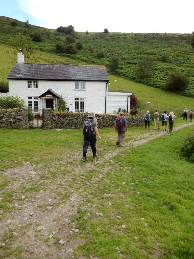
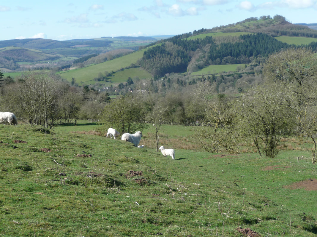
Description of Walk: We car-share to the pretty hill-top village of Wentnor, six miles north-east of Bishop’s Castle. Adstone Hill nestles between the wilds of the Long Mynd and the Stiperstones, in an area of pastoral tranquility. Our walk skirts around the hill and then over it, using quiet lanes, pasture and meadows. There will be wonderful views and wild flowers, and perhaps we’ll hear the call of the curlew.
Cost £5.00
Cost £5.00
THURSDAY 16TH MAY 2024
|
|
Description of Walk: From the car park we head south along an open access path, across three fords and down to Medwaledd farm. Turning right, we take a short but steep climb to Big Wood for a coffee break. We continue along another open access track to Bryn-garw, and then make a long steep ascent of Cilfaesty Hill, where we may encounter sheep, cattle and ponies. We then pass Bryn Coch, the source of the River Teme, and climb gently up to Two Tumps tumuli on the Kerry Ridgeway. The return to the car park is a pleasant 2 mile stroll along the Ridgeway, slightly downhill all the way, hopefully enjoying the amazing all-round views of the Brecon Beacons, Bromlow Callow and the Stiperstones to Brown Clee.
Bring waterproofs, a drink and a lunch, and wear walking boots. Parking is free at Block Wood, but share transport if you can.
Cost: £5.00
Bring waterproofs, a drink and a lunch, and wear walking boots. Parking is free at Block Wood, but share transport if you can.
Cost: £5.00
THURSDAY 16TH MAY 2024
|
|
Description of Walk: Meet in Bishop's Castle to car share. This circular route passes many important ‘stepping stones’ for wildlife, and travels through varied habitats including woodland, pasture, heath and river corridor. There are great views of the Stiperstones ridge and the Long Mynd. Bring drinks and food to keep you going.
The walk starts and ends at the Bog Visitor Centre, which has an excellent tearoom, a loo, and interesting displays about the local area.
The walk contains a mixture of footpaths and quiet country lanes (be aware of possible traffic). There are some muddy sections, rough paths, hill climbs and descents. Sturdy footwear such as boots are definitely recommended. There are a few stiles to negotiate.
Cost £5.00
THURSDAY 16TH MAY 2024
|
|
Description of Walk: An overview of a century of medicine in SW Shropshire with a view to spotting medicinal plants, myths and secrets en route.
The walk is from Clun to Bishop's Castle, spotting relevant buildings, and along good paths, forest tracks and across meadows. It will reflect the interests of your leaders, offering a healthy insight into our countryside. We take time to enjoy the grand views with the detail of medicinal plants. You will need supplies of food and drinks, waterproofs, sunhats and stout footwear.
Cost £7.50
THURSDAY 16TH MAY 2024
|
|
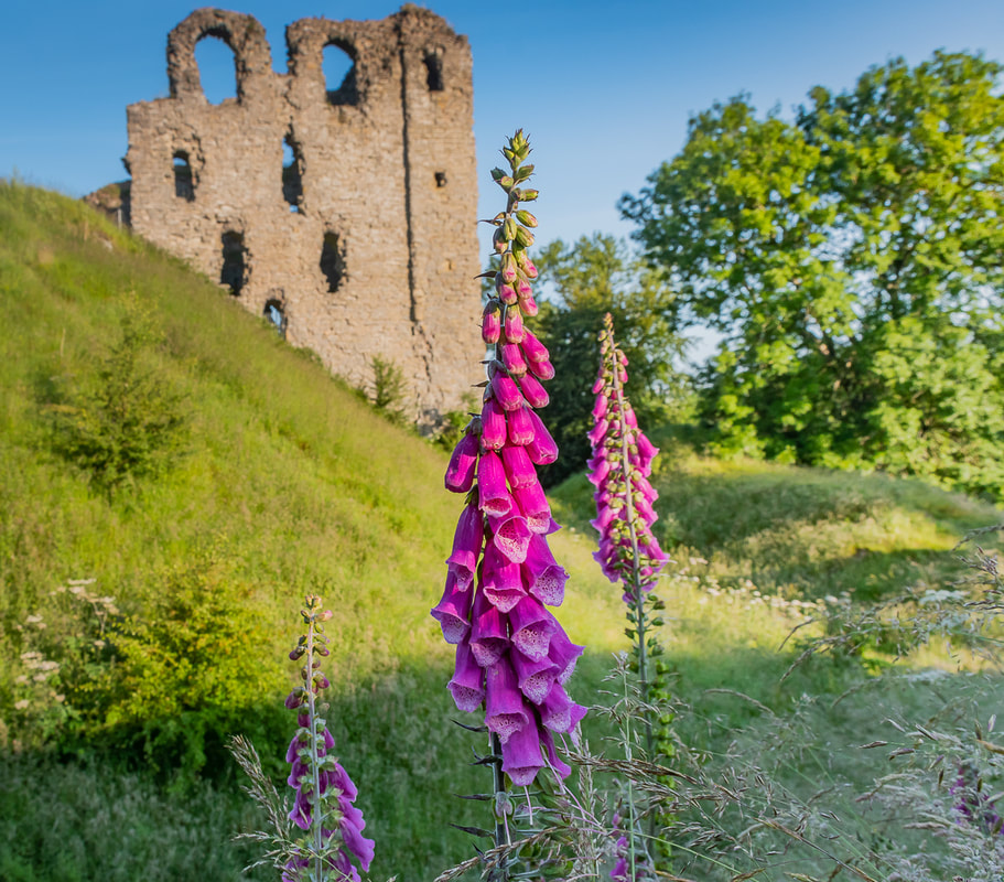
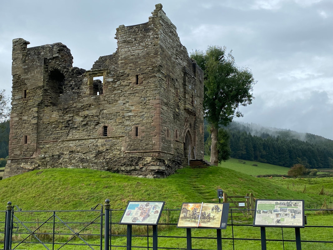
Description of Walk: The walk starts at the ruin of Hopton Castle, site of a short siege in the English Civil War. Early in 1644 the castle was held by a Parliamentary garrison but ended in their surrender to the Royalists and their bloody murder. We will walk from this historic hamlet through the beautiful Cwm valley and using footpaths, lanes and forest tracks take a circular tour of Well Wood, Black Hill Forest, Sowdley Wood, Clunton Coppice and Purslow Wood. Out of the woods the views of the valley and castle below are delightful. Bring plenty to drink, lunch and snacks.
Cost £5.00
Cost £5.00
THURSDAY 16TH MAY 2024
|
|
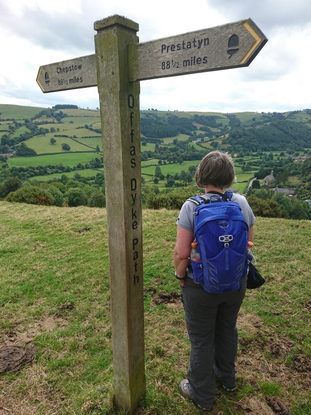
Description of Walk: An out and back route which starts with a dingle, wooded hill edge and the small hamlet of Mainstone. The route then leaves the valley and joins Offa's Dyke revealing panoramic views. There are more switchbacks on the national trail, through valleys, wooded slopes to the Dog and Duck, sadly a redundant pub. Onwards for return leg across fields, sunken lanes with lots of good views north, then to Bankshead and onto Bishop's Castle for optional refreshment. Bring lunch and enough drink for the journey.
Cost £5.00
Cost £5.00
FRIDAY 17TH MAY 2024
|
|
Description of Walk: A walk on Stapeley Hill visiting a Bronze Age Stone Circle, a petrified witch, burial cairns and a prehistoric pathway. People have visited, lived and left evidence in this area for a very long time. Our visit will be one of those trips and with clear views east and west we will appreciate why the place has held such significance over the eons. Good grassy paths or tracks with gentle slopes give time to look around. Bring drinks and a snack for a shorter day out in this borderland.
Cost £5.00
Cost £5.00
FRIDAY 17TH MAY 2024
|
|
Description of Walk: The walk focuses on the wildlife and heritage of Hope Valley.
Hope Valley is home to the rare hazel dormouse, and a host of other animals and spring plants. From Bank Farm there are superb views of the Stiperstones National Nature Reserve, and we learn about the Bank Farm tragedy and its links to Agatha Christie’s famous play “The Mousetrap”. Holy Trinity Church contains a colony of Brown Long-Eared bats, and there is a variety of large and unusual trees in the churchyard, as well as the graves of some of the victims of the Snailbeach mine disaster of 1895.
We will walk through Bentlawnt village and down a sunken lane to Oak Edge. Crossing the A488 we climb steeply up to Bank Farm, descend to Bank Coppice and walk through fields to cross the A488 again, entering Hope Valley Nature Reserve. We then cross fields via Stables Inn, an old drovers inn, and down to Holy Trinity church. The walk includes two steep ascents and several stiles.
Bring a drink and a snack, waterproofs and wear walking boots. There is free parking at the Village Hall, and donations are welcome to help maintain the Hall.
Cost £5.00
FRIDAY 17TH MAY 2024
|
|
Description of Walk: We car-share for this walk, which starts in Newcastle on Clun.
A circular walk on the western edge of the Shropshire Hills National Landscape, linking the Shropshire Way with the Offa’s Dyke Path at Hergan, with its gap in the Dyke. The walk then returns along Offa’s Dyke Path to the midpoint of the Trail, with fabulous views of Newcastle and the Clun valley. A hilly walk amongst beautiful unspoilt scenery!
Please bring lunch and drink, suitable footwear and waterproofs.
Cost: £5.00
FRIDAY 17TH MAY 2024
|
|
Description of Walk: This route uses rarely walked paths and offers glorious insights into our National Nature Reserve. It will have surprises, challenges and many occasions to stand and stare. Walking around this iconic ridge of Mary Webb, Wild Edric & Malcolm Saville fame, we shall explore some of the wonders of the nature and social history surrounding the tor-pocked ridge.
It is an exposed area, providing mystery in rough weather and offering remnants of squatters homesteads, where shelter may still be gained. Some of the paths were originally from home to mine or chapel and provide that direct link with the history of the area and the bravery of those settlers (on the edge of steep slopes!).
We'll finish our day with a visit to the Bog Centre, another remnant of a long gone mining community, where hospitality is offered by the community members living in this special place.
Please bring your drinks and food supply for a day out in the hills, spare and waterproof clothing and strong footwear on your feet.
Cost £5.00
FRIDAY 17TH MAY 2024
|
|
Description of Walk: Taking in the hidden hills of the Redlake Valley on the south-western borders of the National Landscape, this walk climbs from Chapel Lawn to view the quillets of Brineddin Wood. From here we will enjoy the view across the valley to our destination: Caer Caradoc (South). Then, much like the Ancient British rebel war chief, we will cross the valley, eventually sneaking up on the our destination from an unexpected direction. Caer Caradoc (South) is one of the finest hillforts in the Shropshire Hills and arguably as impressive as its northern cousin; an excellent place to discover Caradoc's story. Good paths, tracks and lanes take us up and down this valley, across the River Redlake and onto the open access land around the top, for the splendid views in all directions. Battle plan organised, bring supplies for self sustaining journeys – lunch and drink, and a good pair of boots.
Cost: £5.00
Cost: £5.00
FRIDAY 17TH MAY 2024
|
|
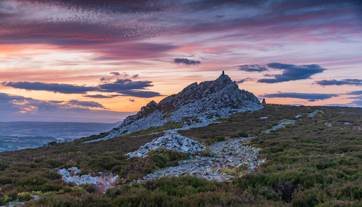
Description of Walk: A spectacular linear walk with stunning views, steeped in history, legend and myth. Starting from Bishop's Castle we travel by minibus to the old lead mining village of Snailbeach. From there we follow the Shropshire Way up and along the Stiperstones Ridge with its famous quartzite rocky outcrops including Manstone Rock, the second highest point in Shropshire (536m). After descending from the ridge we continue along the Shropshire Way, over Nipstone Hill and Linley Hill (watch out for red kites and buzzards), through the hamlet of More and back to Bishop's Castle.
This is a strenuous and exposed full-day walk with some sections of uneven and rocky ground. Please bring drinks, food supply and waterproofs, spare clothing, strong footwear and poles. The only public toilets available are at the drop off car park.
Cost: £10.00
This is a strenuous and exposed full-day walk with some sections of uneven and rocky ground. Please bring drinks, food supply and waterproofs, spare clothing, strong footwear and poles. The only public toilets available are at the drop off car park.
Cost: £10.00
SATURDAY 18TH MAY 2024
|
|
Description of Walk: This route uses rarely walked paths and offers glorious insights into our National Nature Reserve. It will have surprises, challenges and many occasions to stand and stare. Walking around this iconic ridge of Mary Webb, Wild Edric & Malcolm Saville fame, we shall explore some of the wonders of the nature and social history surrounding the tor-pocked ridge.
It is an exposed area, providing mystery in rough weather and offering remnants of squatters homesteads, where shelter may still be gained. Some of the paths were originally from home to mine or chapel and provide that direct link with the history of the area and the bravery of those settlers (on the edge of steep slopes!).
We'll finish our day with a visit to the Bog Centre, another remnant of a long gone mining community, where hospitality is offered by the community members living in this special place.
Please bring your drinks and food supply for a day out in the hills, spare and waterproof clothing and strong footwear on your feet.
Cost: £5.00
SATURDAY 18TH MAY 2024
|
|
Description of Walk: Easy walk along lanes and footpaths and an old railway line, which linked Craven Arms with Bishop’s Castle, affording lovely views of the South Shropshire countryside. The route follows the River Onny and passes through the village of Wistanstow. This village is on the old Roman road which linked the Roman settlements and forts at Leintwardine and Wroxeter.
Please bring packed lunch, there will be an opportunity of refreshments at The Discovery Centre, Craven Arms after the walk.
Cost: £5.00
Please bring packed lunch, there will be an opportunity of refreshments at The Discovery Centre, Craven Arms after the walk.
Cost: £5.00
SATURDAY18TH MAY 2024
|
|
Description of Walk: From Bishop’s Castle the walk ascends Oakley Mynd offering views of the Onny Valley and the South Shropshire Hills. We pass through the hamlet of Totterton before making our way to Lydbury North where we will stop for lunch at the Powis Arms.
We will return to Bishop’s Castle by way of a new permissive path, courtesy of the Parish family of Walcot Hall, to Brockton and Colebatch. Finally we will follow the Shropshire Way to the bottom end of town in time for suitable refreshments.
Cost: £5.00
We will return to Bishop’s Castle by way of a new permissive path, courtesy of the Parish family of Walcot Hall, to Brockton and Colebatch. Finally we will follow the Shropshire Way to the bottom end of town in time for suitable refreshments.
Cost: £5.00
SATURDAY 18TH MAY 2024
|
|
Description of Walk: We meet and start the walk at the Auction Yard car park in Bishop’s Castle. This is a 9 mile walk that briefly crosses the border into Wales taking in some great views of the area. Making our way through The Wintles and out of Bishop’s Castle, we take a green lane at Bankshead and cross the border into Wales. Shortly afterwards we return over the border back into Shropshire at Bishop’s Moat. On reaching Upper Woodbatch Farm there are some stunning panoramic views of the countryside. Descending to Middle Woodbatch and then climbing up through Henley Wood, we reach the Shropshire Way which we follow back to the town.
Bring lunch and drinks.
Cost £5.00
Bring lunch and drinks.
Cost £5.00
SATURDAY 18TH MAY 2024
|
|
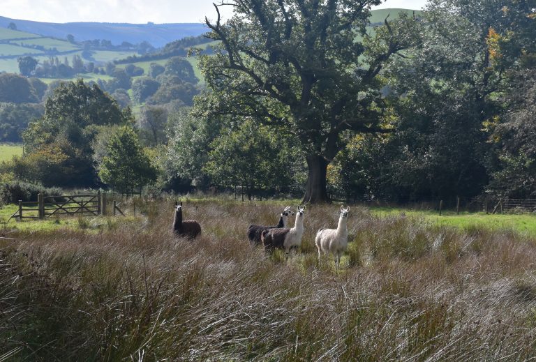
Description of Walk: This circular walk passes through the beautiful Shropshire hills between the renowned Long Mynd and the Stiperstones ridge. From the Bridges car park, the route takes us through the charming Darnford valley and then climbs gently towards the Stiperstones ridge. This takes us through the pasture land and meadows of numerous small livestock farms, including some with rare breeds of sheep and even llamas. There are quite a lot of stiles. At the foot of the Stiperstones ridge, the walk turns westwards with panoramic views across the valley to the Long Mynd and down the valley of the East Onny river. We begin to drop down across open access grassland and deciduous woodland to eventually reach the river itself. A small climb from the valley bottom takes us onto an old drovers’ route offering more spectacular views.
Cost: £5.00
Cost: £5.00
SATURDAY 18TH MAY 2024
|
|
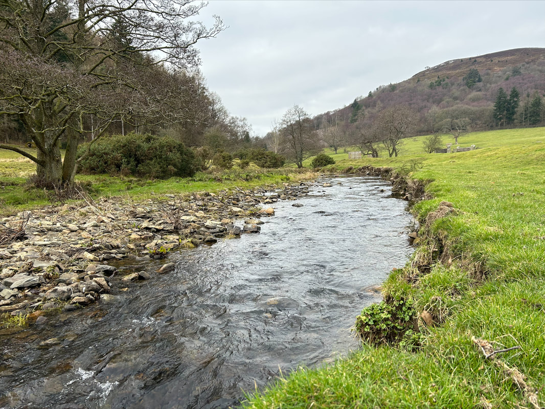
Description of Walk: This walk from Chirbury goes through Marrington Dingle along the River Camlad and then takes us up across the English/Welsh border toward Churchstoke. We turn back and the 4 peaks of Todleth, Roundton, Lan Fawr and on up to the summit of Corndon. It is all down hill after the lunch stop, going along to Mitchell's Fold Stone Circle, then back via Middleton and Heightley to Chirbury. Come prepared for all food stops and weathers on the tops, whatever the season.
Cost £5.00
Cost £5.00
SUNDAY 19TH MAY 2024
|
|
Description of Walk: Richard Payne Knight was part of the 18th century Picturesque Movement and developed these walks and follies to entertain his guests on his private estate. Still privately owned, this is a rare chance to visit this nature reserve and SSSI. The shortness of the walk belies some steep climbs and descents on narrow paths. Agility and a head for heights are needed and walking poles recommended. Limited parking means meeting in Bishop’s Castle and car sharing out and back, returning 1.30 pm. Bring a drink (and snack) for a mid walk stop.
Cost £5.00
Cost £5.00
SUNDAY 19TH MAY 2024
|
|
Description of Walk: A gently paced walk through meadows, quite lanes and grassy tracks, with a couple of uphill gradients and the option to walk onto the summit of Roundton Hill (the site of an Iron Age hillfort). Roundton, where we start and end our walk, is a National Nature Reserve, owned by Montgomery Wildlife Trust. The walk takes us past abandoned dwellings and old quarry workings, with stunning views into Wales and England (weather permitting!) and we’ll be pointing out interesting plants and animals along the way. You may want to bring a packed lunch with you to enjoy after the walk and explore more of Roundton, including the summit and hillfort, at your own leisure.
Please wear walking boots and suitable walking clothing to suit the weather, and bring refreshments to have on the walk. We will set off at 10am from the Roundton Nature Reserve car park. Car share if you can, parking spaces for around 12 cars.
Cost £5.00
Please wear walking boots and suitable walking clothing to suit the weather, and bring refreshments to have on the walk. We will set off at 10am from the Roundton Nature Reserve car park. Car share if you can, parking spaces for around 12 cars.
Cost £5.00
SUNDAY 19TH MAY 2024
|
|
Description of Walk: The prettiest village, two Iron Age Forts, Perry Gutter, Hopesay, Wart Hill and an Arbor tree...are you intrigued? A lovely varied walk with beautiful countryside and good views. The minibus drops us in Hopesay village, and we proceed along the track at the bottom of the hill. We walk on minor roads towards Cheney Longville. Having walked through the woodland, we climb to the summit of Wart Hill and gaze across to another impressive Iron Age fort. We emerge onto common land with a steep descent. Then a loop back via Aston on Clun, return with time to visit the church before our journey back to Bishop’s Castle on Dial a Ride minibus. Walking boots and waterproofs essential, coffee flask/drinks and picnic lunch desirable.
Cost £9.00
Cost £9.00
SUNDAY 19TH MAY 2024
|
|
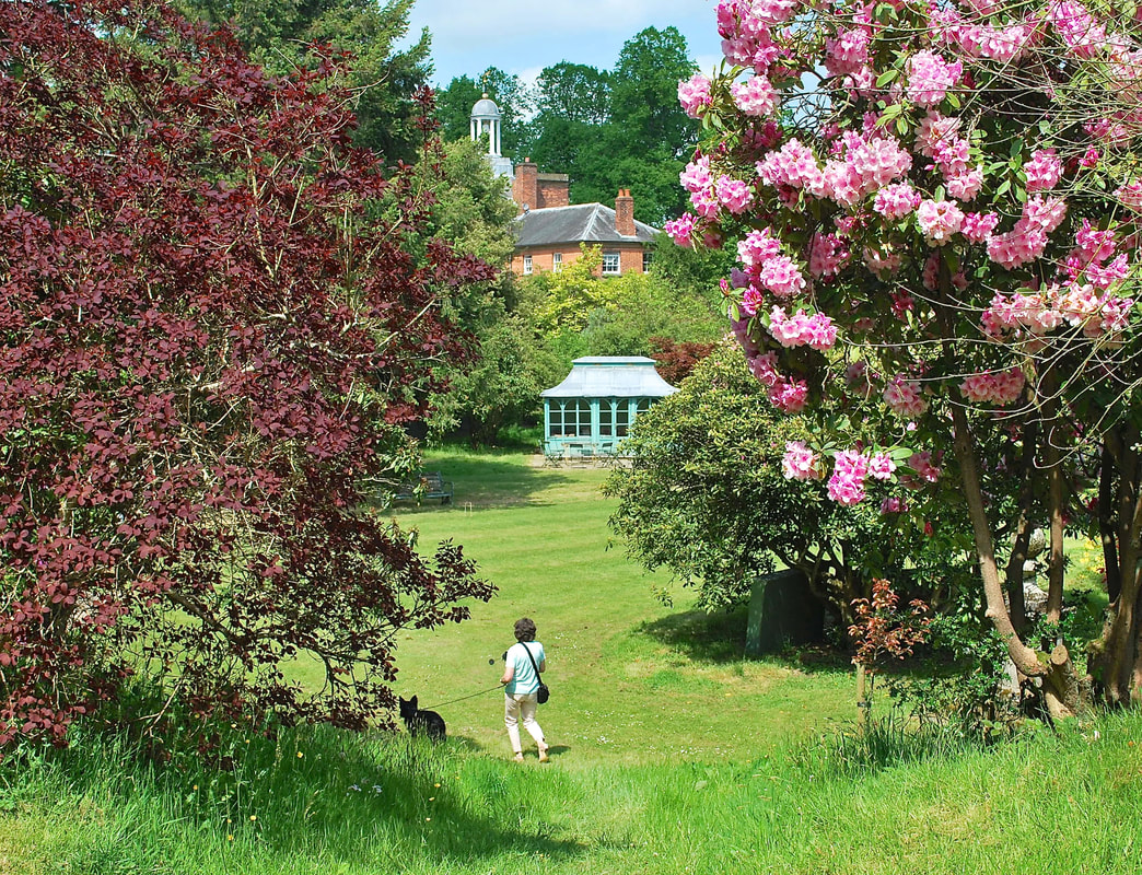
Description of Walk: We start this circular walk from Bishop’s Castle heading SE along the Shropshire Way, dropping down to the small hamlet of Acton, walking through a garden, we head towards Bury Ditches (but not the top) and then make our way down to Walcot Hall. The owners of the Hall have very kindly given us permission to walk through their grounds and arboretum, which normally will be lovely in May. We will take our time to go through the arboretum. Leaving the estate past the lakes we head to Lydbury North 13th Century Church, which has some interesting features. Our journey back to Bishop's Castle takes us up on to the ridge behind Lydbury North and onto the lanes at Totterton, where we turn back towards Bishop's Castle.
Cost £5.00
Cost £5.00
SUNDAY 19TH MAY 2024
|
|
Description of Walk: Using the minibus to Clun we will then head up a quiet lane to join the bridleway through Sowdley Wood, where majestic Douglas Fir clothe the hillside on the south side of the Clun Valley. We’ll walk through the SWT Nature Reserve of Clunton Coppice, home to the elusive Pine Marten and Dormouse, before traversing Purslow Wood on quiet forest rides. The return journey follows bridleways and tracks over open ground with views of lesser-known valleys and hills, before we climb up onto Black Hill, to visit Whinberry Hill common, where conservation work is underway to restore open heathland habitats. A final section through beautiful oak woods around the Rock of Woolbury will return us to Woodside and our quiet lane back into Clun.
Bring lunch and drinks.
Cost £10.00
Bring lunch and drinks.
Cost £10.00